
Choose Your Course
Select a course to access the full outline, weekly topics, materials, resources, and project workflow.
RWR4015
GIS
Traffic Simulation
Urban Planning
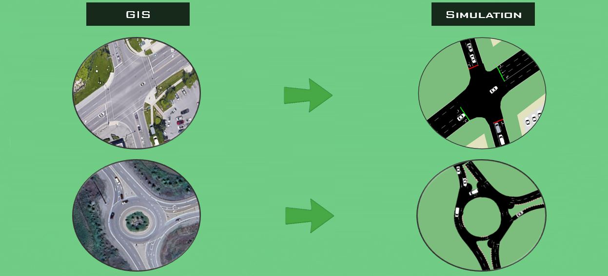
Traffic Simulation for Planning Applications
Use traffic simulation to model, test, and justify planning decisions.
- Build foundational skills in traffic simulation modelling
- Create simulation models using open-source tools (SUMO, QGIS)
- Use simulation for planning applications (signals, designs, etc)
- Compare alternatives using delay and level of service metric
RWR4013
Computer Vision
Digital Twins
Smart Cities
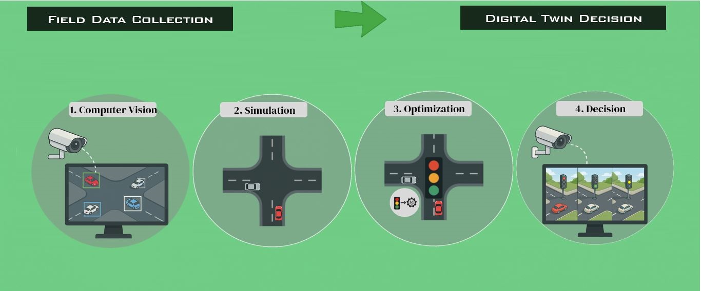
Digital Twins for Smart Cities
Learn Smart-City Digital Twins: Real-Time Traffic Data to Decisions
- Data layer (Computer Vision): collect field traffic data from video
- Model layer (Simulation): build a digital traffic model in SUMO
- Service layer (Optimization): evaluate system performance
- User layer (Decision): choose the most effective strategy
Choose Free Educational Application
Select an application to watch a short demo and open the GitHub repository.
App
SUMO ↔ Unity
3D / VR
Human-in-the-Loop
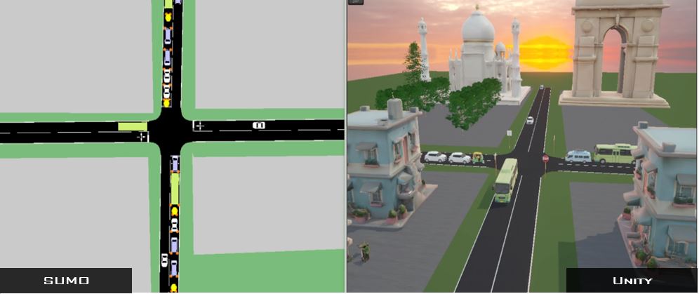
SUMO2Unity
A 3D Enhanced Traffic Visualization and VR/Simulator Human in the Loop Simulation
- Import complex road network from SUMO to Unity
- Integrate SUMO and Unity
- Includes free 3D models (roads, trees, buildings, traffic lights)
- No advanced technical setup required to get started
App
YOLO Detection
Tracking + Speeds
Planning KPIs
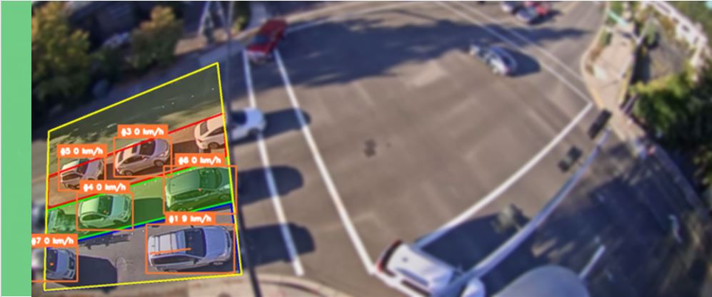
SimJam ComputerVision Analytics
Traffic Detection & Analysis Application Using Computer Vision (YOLO Algorithms)
- Detect traffic objects (cars, trucks, buses, etc.)
- Track objects and compute counts, speeds, trajectories
- Analyze performance measures (LOS, delays, and more)
- Export CSV summaries for planning studies
Need Help?
Office Hours: appointment by email, or ask questions and follow announcements in the community Discord.